Products
ISP – One platform for all sensors
The Integrated Sensor Platform (ISP) is a hardware basis for easy integration of a large variety of sensors without any effort for mouniting and calibration (fixed lever arms to each sensor).
The ISP includes 3 Multi-frequency, Multi-GNSS (GPS + Galileo + Glonass + Beidou) receivers, high-grade MEMS IMU, a barometer, a CAN interface for reception of vehicle data (wheel odometry and steering angle), an LTE module for reception of RTK/ PPP corrections (e.g. from ANavS® RTCM reference station), and the powerful ANavS® Sensor Fusion on a single board. The latter one performs a tight coupling of all sensor data with an Extended Kalman Filter (EKF).
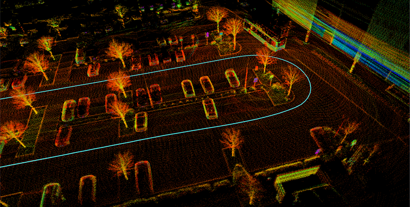
On top of the standard sensors a fully integrated computer vision module is equipped, that can be flexibly configured with two cameras and/or a 3D-LiDAR.
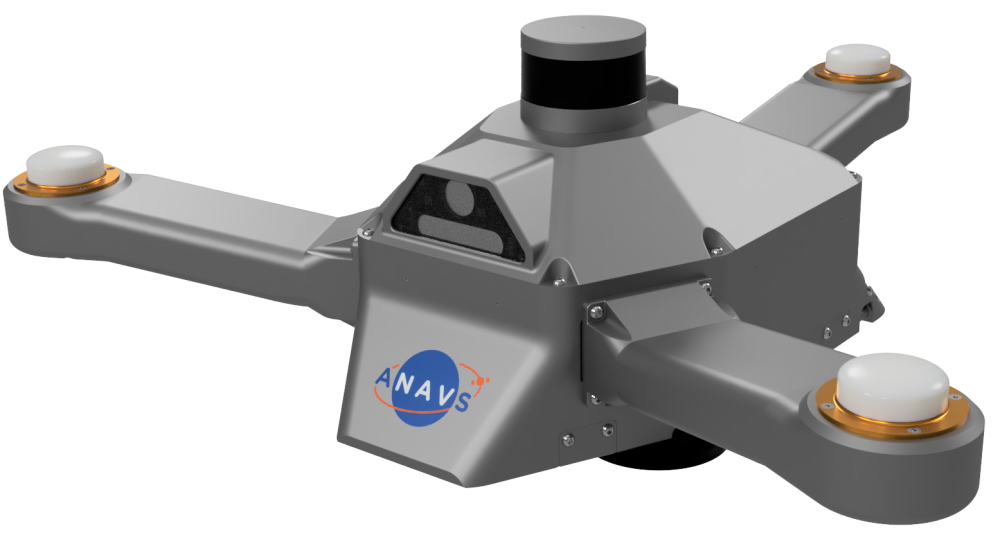
The camera only configuration includes a high-quality, high frame-rate global shutter monocular HD camera and a global shutter stereo camera with either fisheye objective or depth sensing capabilities.
The LiDAR only configuration includes a high-quality 3D-LiDAR for 360° sensing.
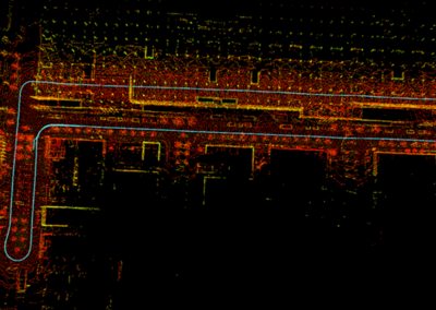
On the one hand, both the camera sensors and the LiDAR sensor provide an additional odometry or positioning information through visual-inertial odometry or Simultaneous Localization and Mapping (SLAM). On the other hand, 2D and 3D maps of the environment or road can be generated. Furthermore, semantic segmentation enabled by deep learning algorithms allows to add semantic information to the maps and further enhances the SLAM performance.
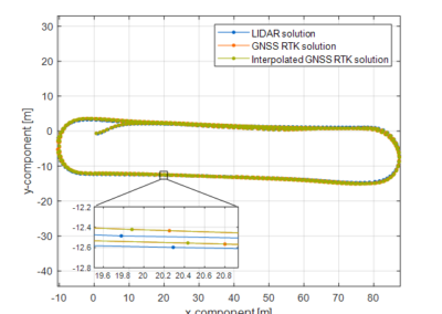
The additional positioning information obtained from the computer vision module is coupled with GNSS, IMU and wheel odometry information in the ANAVS Sensor Fusion. This leads to an improved positioning accuracy to overcome also the most challenging environments.
The ISP supports both Real-Time Kinematics (RTK) and Precise Point Positioning (PPP). RTK positioning uses measurements from a terrestrial reference station (e.g. ANavS® RTCM reference station) that are sent to the ISP via internet or long-range UHF modem. PPP uses satellite position, clock offset, phase and code bias corrections that are sent via internet or directly via satellite (using Galileo’s High Accuracy Service, HAS). The RTK positioning typically provides a higher positioning accuracy and faster convergence than PPP, but requires at least a partial internet coverage of your target application region and proper reference station infrastructure.
The ISP is ready to use out-of-the-box. With its vacuum cup it can safely be mounted for any kind of automotive dynamics.
Accurate Position and Attitude
- Precise absolute RTK positioning:
horizontal accuracy:
sigma = 1.0 cm
vertical accuracy:
sigma = 2.0 cm - Precise absolute PPP positioning:
horizontal accuracy:
sigma = 15 cm
vertical accuracy:
sigma = 20 cm - Precise absolute attitude (heading, pitch, roll):
sigma = 0.25° for 1 m distance
between the GNSS antennas
High Precision Maps (2D/3D)
- Online/Offline Map-Building and Localization
- Drift-free localization in indoor/outdoor scenarios with SLAM
Object detection (using Artificial Intelligence)
- Trained AI according to customer needs and application
- 3D bounding boxes for detected objects
Interested? Send us a request!
Receive more Infos of our ISP based on your needs!
Why should I use the ANavS® ISP?
- The patented ANavS® tightly coupled sensor fusion provides real-time 3D-position, 3D-attitude (heading, pitch, roll), 3D-velocity and 3D acceleration information with an update-rate of up to 120 Hz.
- The new Integrated Sensor Platform (ISP) stands for the combination of classical sensor fusion with artificial intelligence algorithms for autonomous driving, map creation and object detection/classification and includes all necessary sensors in combination with powerful processors:
- Multi-GNSS, Multi-Frequency, Multi-Antenna setup
- Inertial Sensors
- Cameras
- 3D-LiDAR
- The ISP is the perfect setup for research departments and universities to gather easily timestamped sensor data for all common sensors. The user can concentrate on developing his algorithms, without taking care about the hardware platform or lever arms.
