

ANavS® – Advanced Navigation Solutions
A leading company in the development of high-precision positioning systems using tightly coupled sensor
fusion and artificial intelligence/ machine learning approaches for SLAM, mapping and object tracking.
ANavS – the Collaborative Change Makers
Shaping the future of positioning – with customized solutions for every application.
The core of the ANavS® positioning system is a modular and flexibly configurable sensor fusion of GNSS, inertial, odometry, camera and lidar measurements. The innovative positioning algorithms have been developed and patented by ANavS® and incorporate the latest RTK / PPP technologies (including compatibility with the latest Galileo High Accuracy Service (HAS)) and AI methods.
Product Lines
ANavS® product lines are divided into three different systems, the A-ROX, AI-ROX and G-ROX system:
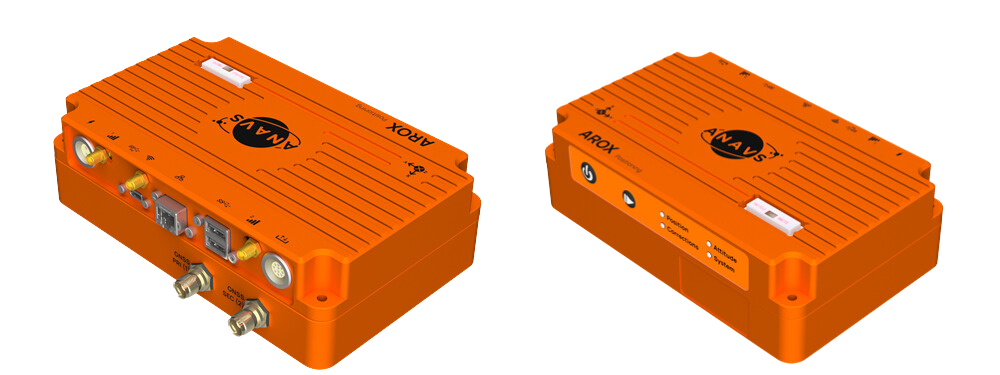
- The A-ROX GNSS-INS tightly coupled positioning is the real-time ground truth measurement equipment for dynamic automotive, railway and maritime applications.
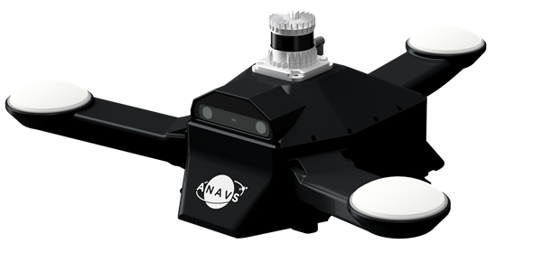
- The AI-ROX system is based on the A-ROX system. It is extended with a powerful 128-channel LiDAR and a stereo camera, enabling e.g. SLAM-based localization for GNSS-denied environments or fully/ partially indoor environments.
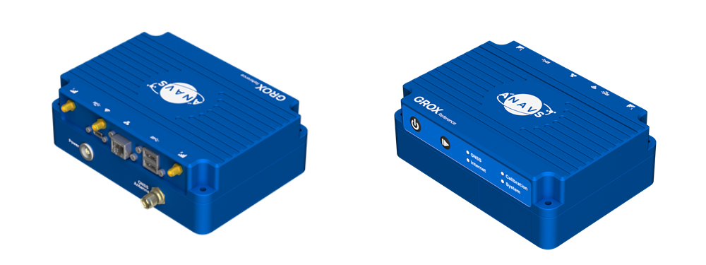
- The G-ROX RTK reference station is a high-quality solution to ensure the best possible performance of your RTK positioning system without any service provider costs. It includes a cloud based RTCM service.
The product lines A-ROX and AI-ROX systems keep pace with the latest developments of the European Galileo satellite navigation system. ANavS® acts as a reliable R&D partner for ESA (European Space Agency) and EUSPA (European Union Agency for the Space Programme) for current and future technologies in the field of navigation. In particular, the integration and utilization of the new High Accuracy Service (HAS) enables a global positioning accuracy of less than 20 cm for the first time without the need for a correction data service – even in the air and on the oceans. In addition to the HAS, another important feature is the Open Service Navigation Message Authentication (OSNMA) and used to detect and mitigate the spoofing of Galileo satellites.
Innovation to the Point
Accurate Positioning
HAS Technology Inside
OSNMA
ROS-2
Web-App
Minimal Warm-Up Time
Breakthrough Price
Made in Germany
Customized Engineering Service
Our development team includes experts from all offered positioning sensors and their fusion. It is our pleasure to support you from the planning phase to the final system integration. Are you interested in our sensor fusion framework or do you have any question about it?
Please don’t hesitate to contact us.
More information about our customized engineering projects.
Our Key Customers
Automotive
Railway
Defense
Research
Quick overview
Products
Equipped for every situation with the need of high-precise positioning & navigation: AI-ROX, A-ROX, G-ROX, MSRTK, Snow Monitoring and M.2 SMART Card.
R&D Projects
Our R&D team is constantly working on researching, developing and implementing new technologies to master the challenges of tomorrow.
Publications
Our publications are varied, provide well-founded findings and present innovative solutions: Journal and Conference papers, Patents and Theses
Any questions?
Feel free to ask!
ANavS GmbH
Phone: +49 (0) 89 89056721
Email: info@anavs.de
Web: www.anavs.com
